
Using Climatology in Forecasting Convection in West and Central Africa
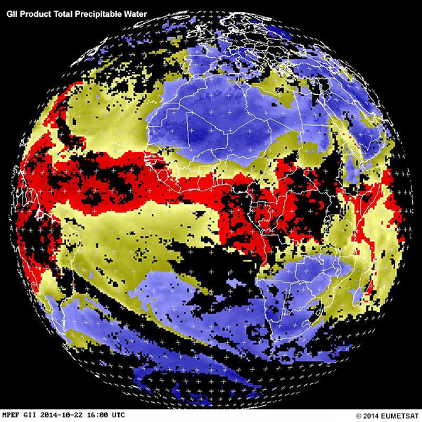
This case-study lesson provides an opportunity to apply the information in the ASMET lesson “Satellite-Derived Climatology Products for Monitoring Convection Over West and Central Africa” to a case that occurred over West and Central Africa in June 2014. It demonstrates how to integrate climatology information with satellite, global instability indices (GII), and NWP data when […]
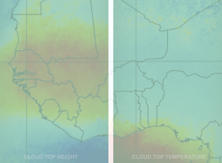
Satellite-Derived Climatology Products for Monitoring Convection Over West and Central Africa
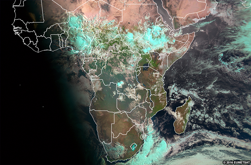
A weather forecaster’s knowledge of climatology is important to the success of a forecast, especially where convection is involved. That’s particularly true over Central and West Africa, where convection has a strong diurnal cycle and usually develops over particular geographic regions and during specific time intervals. The lesson describes satellite-derived cloud climatology products and several […]
Forecasting Heavy Rains and Landslides in Eastern Africa

Good rainfall draws many people to settle across the eastern Africa highlands for farming and other businesses. However, factors such as steep terrain, logging, livestock grazing, agriculture, and construction, have increased erosion and contributed to less stable slopes. These factors can lead to devastating landslides and mudslides, especially during episodes of very heavy rain. Forecasting […]
Utilisation des vents d’ASCAT et d’autres données pour les prévisions maritimes
L’étude de cas contenue dans le présent cours illustre l’utilisation dans les prévisions maritimes du produit vent par diffusiomètre et, dans une moindre mesure, du produit hauteur significative des vagues par altimètre. Une brève introduction aux fronts froids et à leur impact sur les conditions météorologiques et océaniques jette les bases en vue de la […]
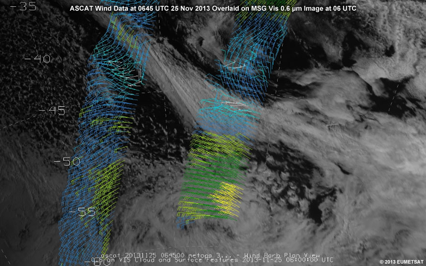
Using ASCAT Wind and other Data in Marine Forecasting
This case study lesson demonstrates the use of scatterometer wind and, to a lesser extent, altimeter significant wave height products in marine forecasting. A brief introduction to cold fronts and their impact on weather and sea state conditions sets the stage for the main part of the lesson, the case study. The case follows the […]
Extreme High Swell Events on the Moroccan Atlantic Coast
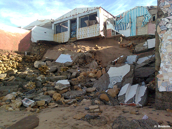
High swell events can develop far from the coast under cyclonic conditions, and take several days to travel to land. If early warnings are not issued, they can take an area by surprise and have a devastating impact. This lesson aims to improve the ability of marine forecasters to forecast extreme marine events related to […]
Interprétation de base de l’imagerie satellitaire
Cette leçon enseigne les bases de l’interprétation des images satellitaires aux prévisionnistes, aux étudiants en météorologie, et aux autres parties intéressées, en mettant l’accent sur la région africaine. Elle commence par décrire brièvement les canaux visible, infrarouge, et vapeur d’eau, ainsi que les produits dérivés RGB. Ensuite, elle apprend à interpréter les caractéristiques des nuages […]
Basic Satellite Imagery Interpretation
This lesson teaches the basics of satellite image interpretation to forecasters, meteorology students, and other interested learners, with an emphasis on the African region. It begins by briefly describing visible, infrared, and water vapour channels, as well as RGBs and derived products. From there, it teaches learners how to interpret clouds and surface features using […]
Basic Satellite and NWP Integration
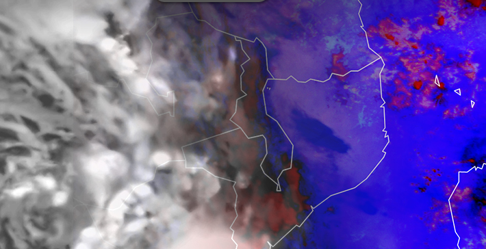
NWP is one of the most important forecasting tools in our toolbox. Yet identifying when/where it isn’t capturing reality is difficult. In the short-term forecasting range, it is important as a forecaster to identify when/where NWP output isn’t matching reality. Then you can make appropriate changes to the forecast output. To find those mismatches anywhere […]
Détection de la turbulence en air clair : etude de cas de l’Afrique du Sud
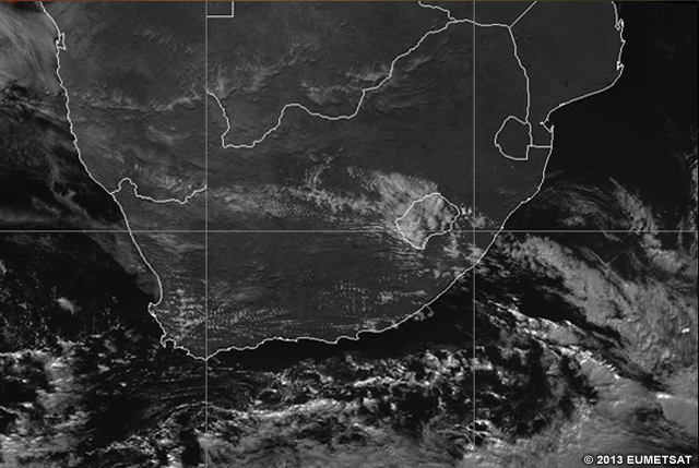
La turbulence à tous les niveaux de l’atmosphère est une préoccupation majeure pour l’industrie de l’aviation. Elle est souvent non détectée dans les zones sans nuages, prenant les pilotes au dépourvu quand ils y volent. La turbulence peut occasionner des blessures aux passagers, aux membres d’équipage, et causer des dommages à la cellule de l’avion. […]